
maps
Digitally created maps of areas local to where I live. Currently stocked in local independent retailers as prints and tea towels. Please get in touch for details if you’re interested in wholesale.


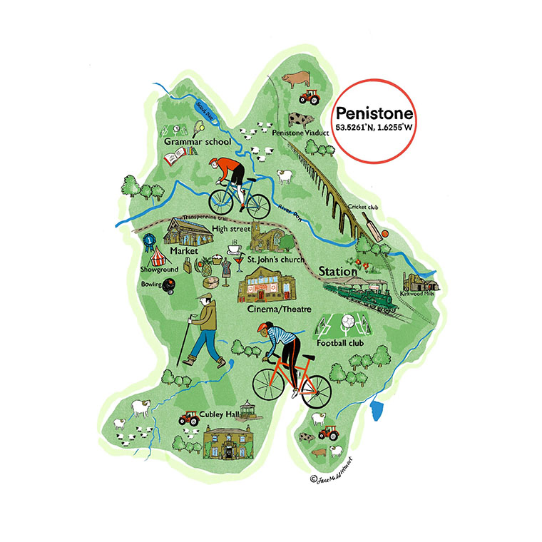


Digitally created maps of areas local to where I live. Currently stocked in local independent retailers as prints and tea towels. Please get in touch for details if you’re interested in wholesale.
| Cookie | Duration | Description |
|---|---|---|
| __stripe_mid | 1 year | This cookie is set by the Stripe payment gateway. This cookie is used to enable payment on the website without storing any payment information on a server. |
| __stripe_sid | 30 minutes | This cookie is set by the Stripe payment gateway. This cookie is used to enable payment on the website without storing any payment information on a server. |
| cookielawinfo-checkbox-advertisement | 1 year | The cookie is set by GDPR cookie consent to record the user consent for the cookies in the category "Advertisement". |
| cookielawinfo-checkbox-analytics | 11 months | This cookie is set by GDPR Cookie Consent plugin. The cookie is used to store the user consent for the cookies in the category "Analytics". |
| cookielawinfo-checkbox-functional | 11 months | The cookie is set by GDPR cookie consent to record the user consent for the cookies in the category "Functional". |
| cookielawinfo-checkbox-necessary | 11 months | This cookie is set by GDPR Cookie Consent plugin. The cookies is used to store the user consent for the cookies in the category "Necessary". |
| cookielawinfo-checkbox-others | 11 months | This cookie is set by GDPR Cookie Consent plugin. The cookie is used to store the user consent for the cookies in the category "Other. |
| cookielawinfo-checkbox-performance | 11 months | This cookie is set by GDPR Cookie Consent plugin. The cookie is used to store the user consent for the cookies in the category "Performance". |
| viewed_cookie_policy | 11 months | The cookie is set by the GDPR Cookie Consent plugin and is used to store whether or not user has consented to the use of cookies. It does not store any personal data. |
| Cookie | Duration | Description |
|---|---|---|
| woocommerce_recently_viewed | session | This cookie gathers information on products which are viewed by the user so as to be able to provide a list of them in various views. It is there to improve user experience using WooCommerce. |
| wp_woocommerce_session_391c0ade216d9be97834cfe8ba0d9c06 | 2 days | This cookie is used by WooCommerce to store performed actions on the website and thus improve user experience. |
| Cookie | Duration | Description |
|---|---|---|
| CONSENT | 16 years 5 months 18 days 14 hours | These cookies are set via embedded youtube-videos. They register anonymous statistical data on for example how many times the video is displayed and what settings are used for playback.No sensitive data is collected unless you log in to your google account, in that case your choices are linked with your account, for example if you click “like” on a video. |
| tk_lr | 1 year | This cookie is set by the Jetpack plugin on sites using WooCommerce. This is a referral cookie used for analysing referrer behaviour for Jetpack |
| tk_or | 5 years | This cookie is set by the Jetpack plugin on sites using WooCommerce. This is a referral cookie used for analysing referrer behaviour for Jetpack |
| tk_r3d | 3 days | The cookie is installed by Jetpack. Used for the internal metrics for user activities to improve user experience |
| Cookie | Duration | Description |
|---|---|---|
| NID | 6 months | This cookie is used to create a profile based on the user's interests and display personalised ads to the users. |
| VISITOR_INFO1_LIVE | 5 months 27 days | This cookie is set by Youtube. Used to track the information of the embedded YouTube videos on a website. |
| YSC | session | This cookies is set by Youtube and is used to track the views of embedded videos. |
| Cookie | Duration | Description |
|---|---|---|
| m | 2 years | No description available. |
| tk_ai | 5 years | Gathers information for WordPress by themselves, first party analytics tool about how WP services are used. A collection of internal metrics for user activity, used to improve user experience. |
| tk_qs | 30 minutes | Gathers information for WordPress by themselves, first party analytics tool about how WP services are used. A collection of internal metrics for user activity, used to improve user experience. |
| wp_api | past | No description |
| wp_api_sec | past | No description |
